Predicting Wildfire Risk Before Ignition
Alberta averages more than 1,200 wildfires per year, and the Wildfire Management Branch is responsible for having the right
resources in position before a fire starts. We built a deep learning model that predicts the likelihood and location of fires by region
for the following day, achieving 80% accuracy and $3.3M in projected annual resource planning savings.
Wildfire Management Branch
$3.3M in estimated annual resource planning savings, 80% wildfire occurrence prediction accuracy.
THE CHALLENGE
Every afternoon, duty officers at Alberta Wildfire face one of the hardest resource allocation decisions in emergency management: where to position aircraft, crews, and equipment for the next day.
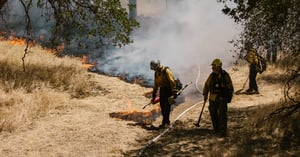
The province averages more than 1,200 wildfires per year across 39 million hectares of protected forest, an area larger than Germany. Fire risk varies dramatically by region, time of day, weather conditions, and season. Getting resources in position before a fire starts is the difference between a contained incident and a runaway blaze.
For decades, duty officers made decisions using only a national fire danger rating system and hard-won intuition. That judgment is real, but it doesn't scale. Less experienced officers lack that pattern recognition, and even veteran duty officers have limited data to work from when conditions are ambiguous.
The result: inefficiency. To manage uncertainty, duty officers often booked standby aircraft and crews that weren't needed. At the same time, in severe years, the province ran out of helicopters entirely. There was no reliable signal to distinguish the days that would demand everything from the days that could be managed with less.
THE SOLUTION
GovLab, AltaML's public sector AI practice, built a deep learning model for Alberta Wildfire that predicts the likelihood and location of fire occurrences by region for the following day.
The model is trained on decades of Alberta's historical fire data, covering location, cause, start time, weather conditions, suppression resources used, and area burned for every wildfire on record in the province. It also integrates regional weather and forest condition data, global emissions data, and day-of-week patterns.
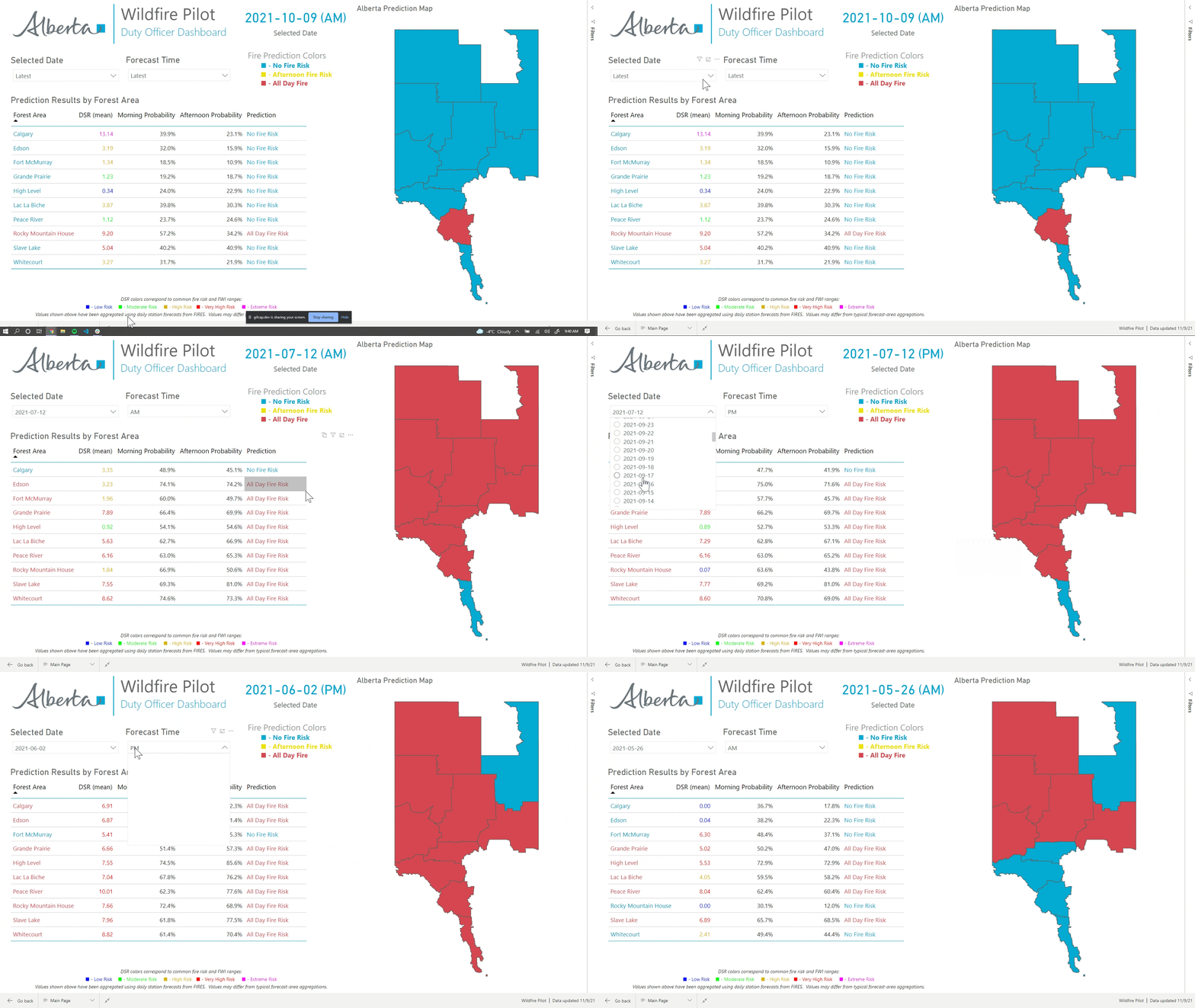
The output is a daily dashboard showing fire occurrence probability by region, split into morning and afternoon windows, so duty officers can see which areas carry the highest risk before positioning resources.
The model is designed to complement the judgment of experienced duty officers, giving them a data-grounded baseline to work from. For officers with less field experience, it encodes the kind of regional pattern recognition that would otherwise take years to develop.
WHY IT MATTERS
Alberta's 2023 wildfire season was the worst in Canadian history. More than 2 million hectares burned in the province, nearly 4,000 international firefighters were brought in to help, and thousands of Albertans were forced to evacuate. In that environment, every resource positioning decision carries weight.
The wildfire prediction model gives duty officers a forward-looking signal before the day begins, grounded in every fire Alberta has ever recorded and updated for current conditions. Specific enough to guide which regions need resources staged, not just whether the province faces elevated risk overall. For a branch managing an area the size of a small country, that specificity is what makes the data actionable.

"New advances in applied artificial intelligence are helping businesses and governments make better decisions and deliver better services. I created GovLab.ai in partnership with AltaML to accelerate our adoption of AI as a problem-solving tool. Our wildfire prediction model is just one exciting example of how Alberta is working to become the most innovative jurisdiction in Canada.”

THIS IS WHAT AI LOOKS LIKE WHEN YOU CAN SEE TOMORROW'S FIRE TODAY.
See more of how we build for the boots on the ground, or talk to our experts. We'd love to hear about what your team is preparing for.